Search
Log in
0
Cart
Shop
Travel Destinations
1000 Islands
Cape Cod
Cape May
California Central Coast
Chesapeake Bay
Inside Passage
Finger Lakes
Flathead Lake
Lake Tahoe
Monterey Bay
Outer Banks
San Juan Islands
Sanibel & Captiva Islands
Santa Catalina Island
City & State Pride
Alaska
Boston
California
Colorado
Hawaii
Maine
Michigan
Minnesota
Montana
New Hampshire
North Carolina
Oregon
Pennsylvania
San Francisco Bay
Texas
Utah
National Parks (A—G)
Acadia
Arches & Canyonlands
Badlands
Banff
Black Hills
Bryce Canyon
Capitol Reef
Denali
Glacier
Grand Canyon
Grand Teton
Great Smoky Mountains
National Parks (I-Z)
Isle Royale
North Cascades
Olympic
Red Rock Canyon
Rocky Mountain
Sequoia & Kings Canyon
Shenandoah
Yellowstone
Yosemite
Zion
International
Africa Collections
Costa Rica
London Collection
Masai Mara
Roosevelt's USA Collection
United Arab Emirates
USA Collection
World Collection
All Products (A-P)
All Products
Blankets
Canvas Tote Bags
Coasters
Chocolate Tins
Drinkware
Gaiters
Kitchen Towels
Magnets
Mini-Maps
Mugs
Notecards
Pouch Tote Bags
Puzzles
All Products (S-W)
Shot Glasses
Stationary
Stickers
Stone Coasters
Story-Maps
Sweet Treats
Travel Drinkware
Wood Puzzles
Wood Signs
Wooden Postcards
Gift Wrapping - $5
100% Recycled paper
Shop Gift Cards
Home
Our Story
About Us
About the Artist
Map Process
Partners & Philanthropy
Missoula Store
Events
Cartography Comes Alive
Travelers Blog
Travelers Blog
Xplore The Sound
Xplorers Club
FAQ
Terms & Conditions
Wholesale
Wholesale
Request Account
Catalog
Faire
Newsletter
Photo Contest
Wholesale FAQ
Customer Support
Group Events
Wedding Favors & Gifts
Contact
0
Featured
Best selling
Alphabetically, A-Z
Alphabetically, Z-A
Price, low to high
Price, high to low
Date, old to new
Date, new to old
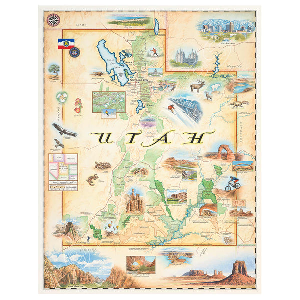
Utah State Hand-Drawn Map
Price
From $29.99
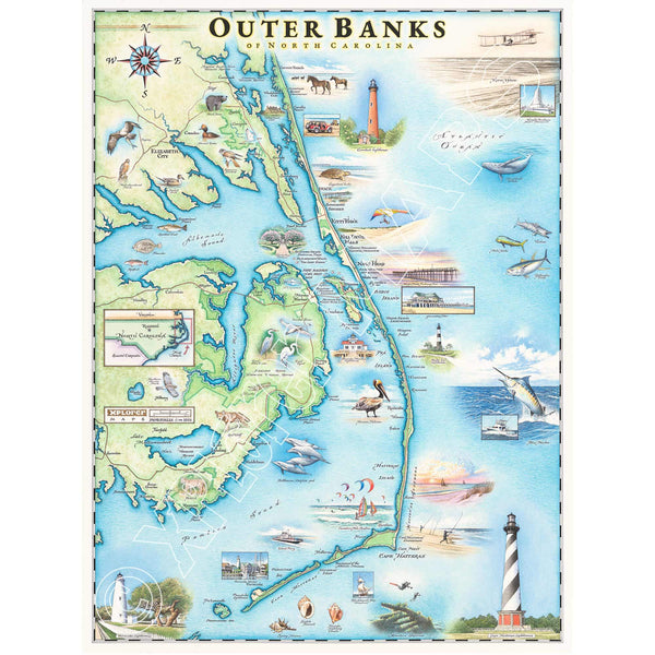
North Carolina's Outer Banks Hand-Drawn Map
Price
From $29.99
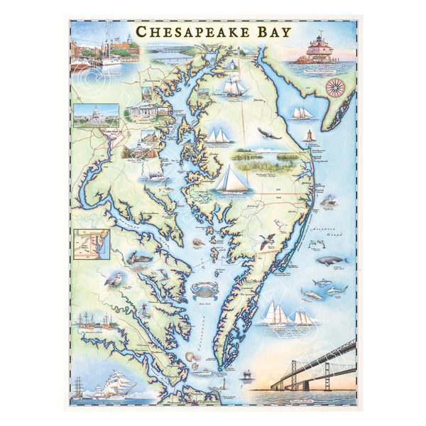
Chesapeake Bay Hand-Drawn Map
Price
From $29.99
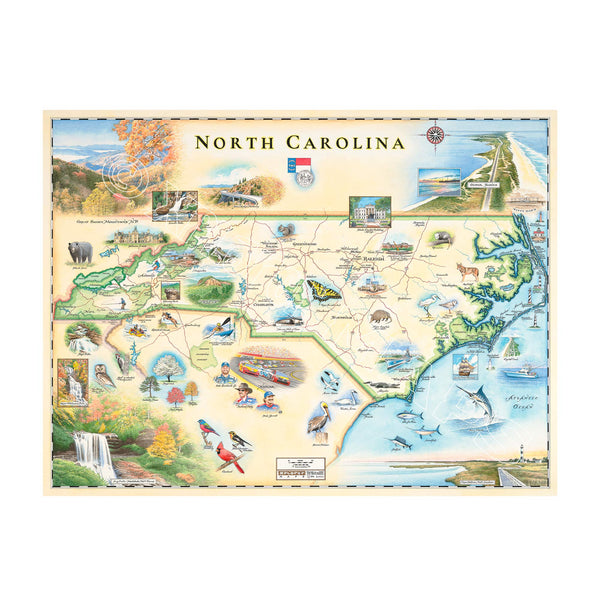
North Carolina State Hand-Drawn Map
Price
From $29.99
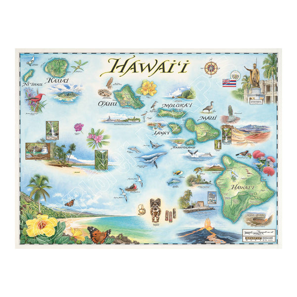
Hawai'i State Hand-Drawn Map
Price
From $29.99
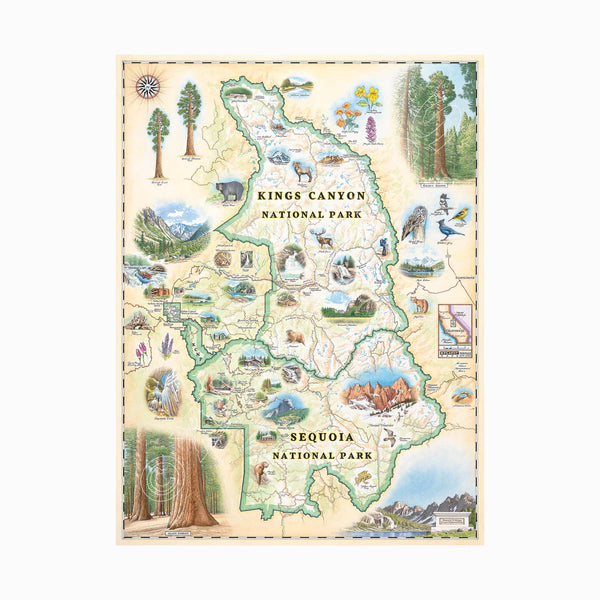
Sequoia & Kings Canyon National Parks Hand-Drawn Map
Price
From $29.99
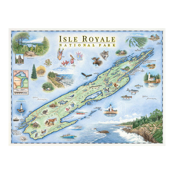
Isle Royale National Park Hand-Drawn Map
Price
From $29.99
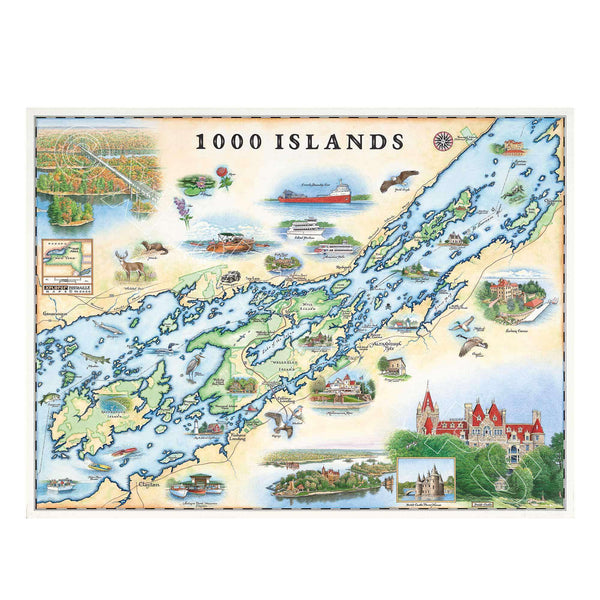
1000 Islands Hand-Drawn Map
Price
From $29.99
Arches & Canyonlands National Park Hand-Drawn Map
Price
From $29.99
1
2
Just Braggin'
Xplorer Maps in the News
Thanks for subscribing
Continue shopping