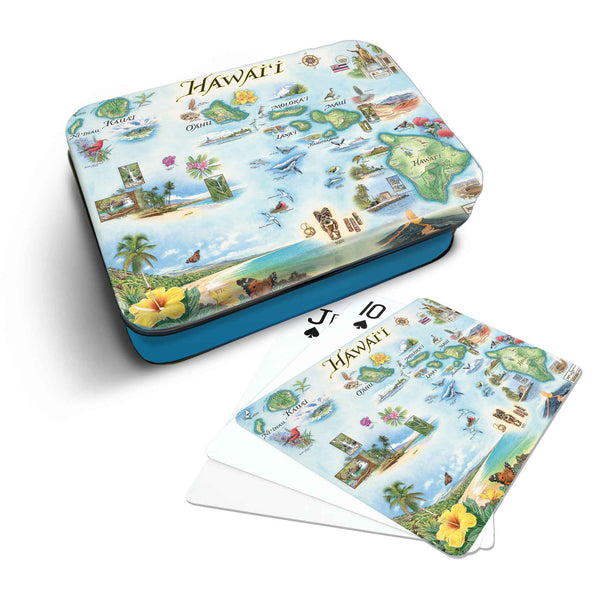
Hawai'i
Original, hand-drawn story map and accompanying gifts of Hawai'i by renowned Illustrator and Xplorer Maps Co-Founder, Chris Robitaille.
Perhaps one of the most beautiful places on Earth, Hawaiʻi is home to more endangered species than any other US state.
The most recent to join the union on August 21st, 1959, the state of Hawaiʻi consists of 8 main islands: Ni’ihau, Kaua’i, O’ahu, Moloka’i, Lāna’i, Kaho’olawe, Maui, and Hawaiʻi (most commonly referred to as the “Big Island” to avoid confusion with the whole state).
Located in the Pacific Ocean about 2,000 miles from the U.S. mainland, Hawaiʻi actually consists of the entire Hawaiian archipelago; 137 islands spanning 1,500 miles that are part of the Polynesian subregion of Oceania.
The islands were originally settled by Polynesians sometime between 124 and 1120. Hawaiʻi was home to numerous independent chiefdoms and is one of only a couple U.S. states to once have been its’ own independent nation. Renowned as one of the world’s most popular “bucket-list” tourist destinations, the state attracts visitors drawn to the unique and diverse culture, warm tropical climate and awe-inspiring natural landscapes.