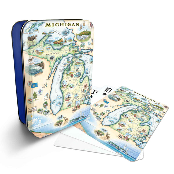
Michigan: The Great Lakes State
Original, hand-drawn story map and accompanying gifts of Michigan by renowned Illustrator and Xplorer Maps Co-Founder, Chris Robitaille.
Originating from the Ojibwe word mishigamaa, meaning “large water” or “large lake”, Michigan was admitted into the union of 1837 as the 26th state. With a population of about 10 million, it is the 10th most populous and the largest state by the total area east of the Mississippi River.
Michigan has the nation’s longest freshwater coastline, is bounded by four of the five Great Lakes and is the only state to consist of two peninsulas; the Lower Peninsula (proudly referred to as the “mitten” by residents) and Upper Peninsula are separated by the Straits of Mackinac. 90% of the “U.P.” is forested land and is an important tourist destination known for its accessible wilderness, unique landscapes, vast wildlife, 150 waterfalls and Soo Locks (where ocean-going freighters make the 21-foot leap from Lake Superior to Lake Huron). And with its deep music roots, automotive heritage, thriving arts and farming communities and endless recreational opportunities, the Lower Peninsula has something for everyone to enjoy year round.
With 100 state parks and public beaches, some of the highest freshwater sand dunes in the world, two national lakeshores, 129 lighthouses, 10 shipwreck museums & diving preserves and the only national marine sanctuary in the Great Lakes (the Thunder Bay National Marine Sanctuary in Lake Huron) Michigan is an absolute must visit!