


Bundle & Save
Hand-Drawn Map Bundle - 4 for $100
$120.00

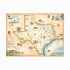
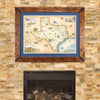
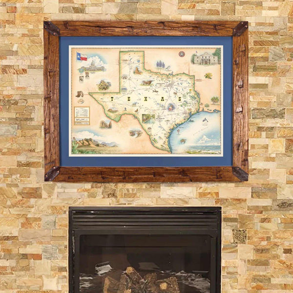
This 24” x 18” unframed lithographic art print features an original hand-illustrated map of Texas, created in pen and ink with watercolor by Xplorer Maps artist Chris Robitaille.
As the second-largest state in the nation, Texas spans an extraordinary range of landscapes, from Gulf Coast shorelines to desert mountains and sweeping plains. The map reflects this geographic diversity across four major regions: the Great Plains, Interior Lowlands, Coastal Plains, and the Basin and Range Province, where the Rio Grande carves the borderlands near El Paso.
Major cities including Austin, San Antonio, Houston, and Dallas are thoughtfully integrated into the composition, alongside iconic destinations such as Big Bend National Park and Guadalupe Mountains National Park. Forested regions, prairie expanses, and coastal ecosystems are woven together to illustrate the scale and character of the Lone Star State.
Cultural symbols and wildlife bring the map to life — longhorn cattle, armadillos, and coastal marine species reflect Texas’ ranching heritage and rich biodiversity.
Blending cartographic precision with artistic storytelling, this piece captures the size, spirit, and layered identity that define Texas.
Product Details
Dimensions: 24” × 18”
Orientation: Horizontal
Print Type: Fine art lithograph
Artwork by: Chris Robitaille, Co-Founder of Xplorer Maps
Ships rolled in protective tube