


Double click image to zoom in


Click image to open expanded view
Bundle & Save
Hand-Drawn Map Bundle - 4 for $100
$120.00


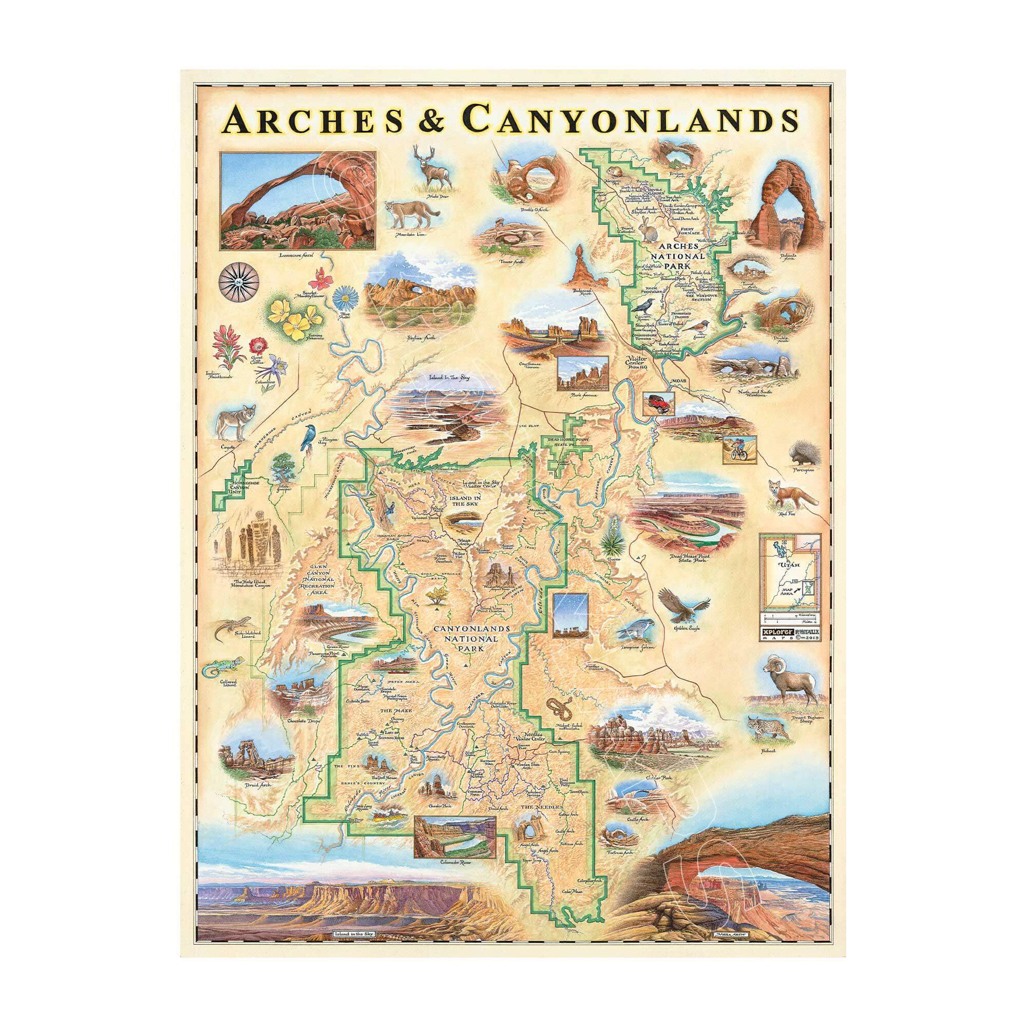
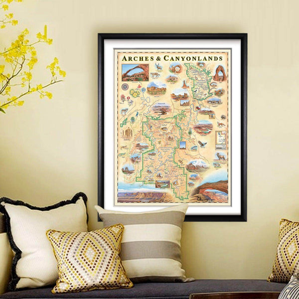
This 18” x 24” unframed lithographic art print features an original hand-illustrated map of Arches and Canyonlands National Parks, created in pen and ink with watercolor by Xplorer Maps artist Chris Robitaille.
Located near Moab in Utah’s southwest desert, these neighboring parks reveal some of the most extraordinary geological formations in the United States. Towering sandstone arches, sculpted fins, deep river canyons, and sweeping mesas tell a story shaped by deposition, erosion, and tectonic uplift over millions of years.
Canyonlands — the larger of the two — is carved by the Colorado and Green Rivers and features landmarks such as Island in the Sky, Druid Arch, and Angel Arch. Just to the north, Arches National Park is renowned for its gravity-defying formations, including Delicate Arch, Double Arch, and Balanced Rock.
Desert bighorn sheep, peregrine falcons, and bobcats move through the landscape, while seasonal wildflowers such as Indian Paintbrush and Scarlet Monkeyflower add bursts of color to the high desert terrain.
Blending cartographic precision with artistic storytelling, this piece captures the scale and raw beauty of Utah’s red rock country — a meaningful tribute for hikers, climbers, river runners, and national park collectors alike.
Product Details
Dimensions: 18” × 24”
Orientation: Vertical
Print Type: Fine art lithograph
Artwork by: Chris Robitaille, Co-Founder of Xplorer Maps
Ships rolled in protective tube
Our on-line store is open 24/7 and we ship Monday through Friday, excluding some holidays. Orders received for products without shipping restrictions on its product page will ship the same business day when received before 12:00 p.m. PST. Orders in high demand will have an estimated production time listed on its product page and will ship according to the date listed.
The Xplorer Maps Warehouse Team strives to ship every order within 1 business day.
For custom orders (including framing), please allow 3-4 weeks for shipping.
Xplorer Maps ships all over the world, but prices and shipping times vary according to state, country, and the weight of items purchased. International recipients are solely responsible for any fees such as, but not limited to, VAT or import duties.
All prices will be charged according to your destination at check-out. This information is shown before your credit card is charged and you can click on the "calculate shipping charges" once an item has been placed in the cart to see the exact shipping based on your zip code.
We ship with UPS and USPS. Expedited shipping options are available at checkout.
Please be aware that despite our prompt shipping, factors beyond our control may occasionally lead to delays in the arrival of your order. For additional questions regarding shipping please email us at: store@xplorermaps.com