


Double click image to zoom in

Click image to open expanded view
Bundle & Save
Hand-Drawn Map Bundle - 4 for $100
$120.00


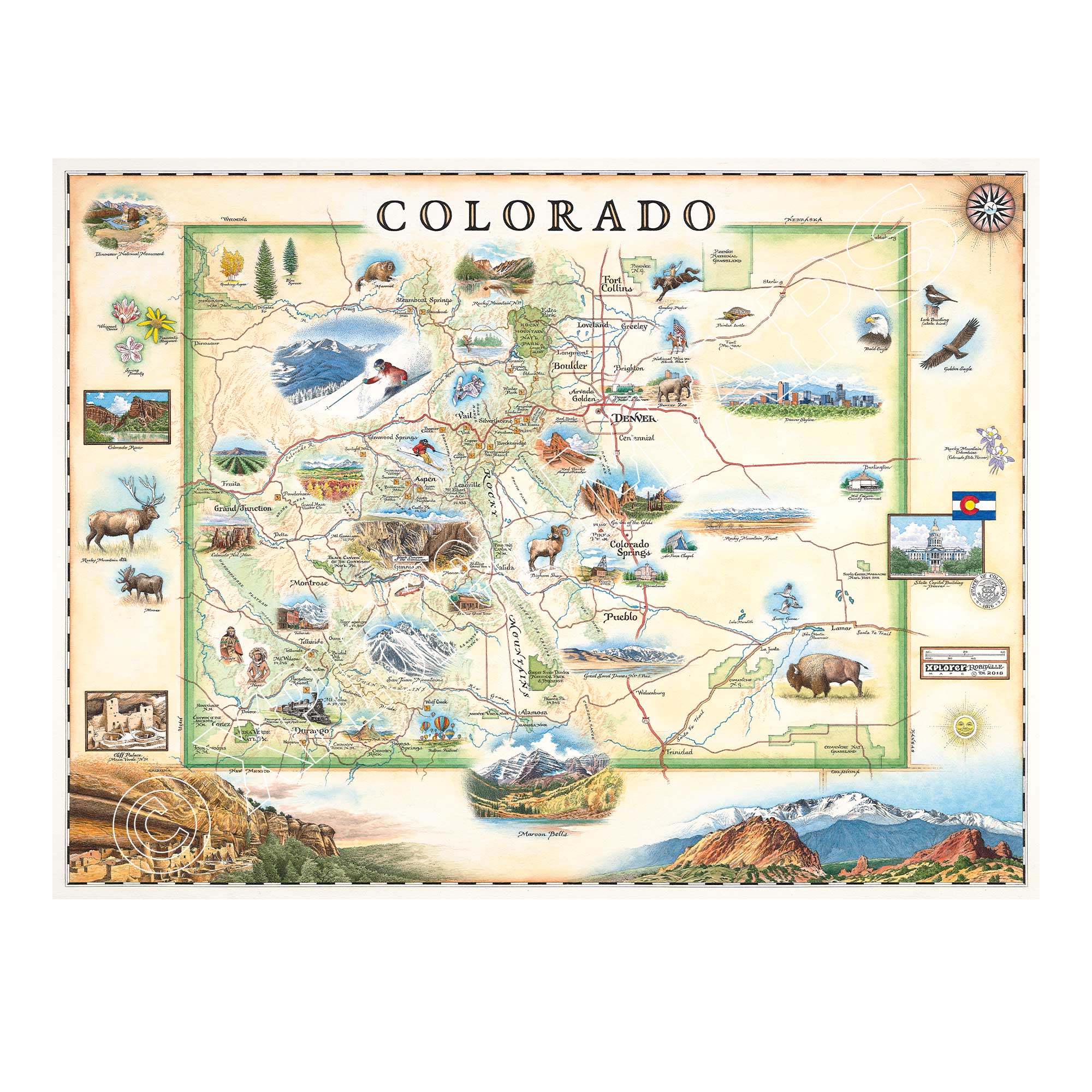
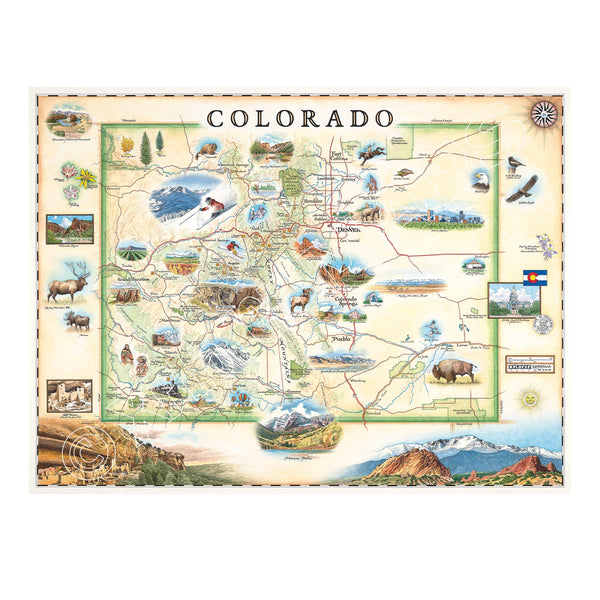
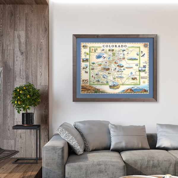
Experience the adventure and breathtaking scenery of Colorado with this 18" × 24" unframed fine art lithograph, featuring an original hand-illustrated map of the State of Colorado by Xplorer Maps Co-Founder and artist Chris Robitaille.
Created in pen and ink with watercolor, this richly detailed artwork showcases Colorado's towering Rocky Mountains, alpine lakes, historic mining towns, high desert mesas, and vibrant cities. Every illustration celebrates the state's remarkable blend of outdoor adventure, natural beauty, and Western heritage.
The map features many of Colorado's most iconic destinations, including Rocky Mountain National Park, Denver, Boulder, Colorado Springs, Garden of the Gods, Mesa Verde National Park, Great Sand Dunes National Park, Maroon Bells, Aspen, Vail, Telluride, Durango, and Pikes Peak. Native wildlife—including elk, bighorn sheep, bison, black bears, bald eagles, and trout—adds life and character to this unforgettable landscape.
Whether you've hiked fourteeners, skied world-class slopes, explored historic mountain towns, or simply love the beauty of the Centennial State, this museum-quality lithograph makes a timeless addition to any home, cabin, or office.
Our on-line store is open 24/7 and we ship Monday through Friday, excluding some holidays. Orders received for products without shipping restrictions on its product page will ship the same business day when received before 12:00 p.m. PST. Orders in high demand will have an estimated production time listed on its product page and will ship according to the date listed.
The Xplorer Maps Warehouse Team strives to ship every order within 1 business day.
For custom orders (including framing), please allow 3-4 weeks for shipping.
Xplorer Maps ships all over the world, but prices and shipping times vary according to state, country, and the weight of items purchased. International recipients are solely responsible for any fees such as, but not limited to, VAT or import duties.
All prices will be charged according to your destination at check-out. This information is shown before your credit card is charged and you can click on the "calculate shipping charges" once an item has been placed in the cart to see the exact shipping based on your zip code.
We ship with UPS and USPS. Expedited shipping options are available at checkout.
Please be aware that despite our prompt shipping, factors beyond our control may occasionally lead to delays in the arrival of your order. For additional questions regarding shipping please email us at: store@xplorermaps.com