


Double click image to zoom in

Click image to open expanded view
Bundle & Save
Hand-Drawn Map Bundle - 4 for $100
$120.00

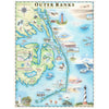

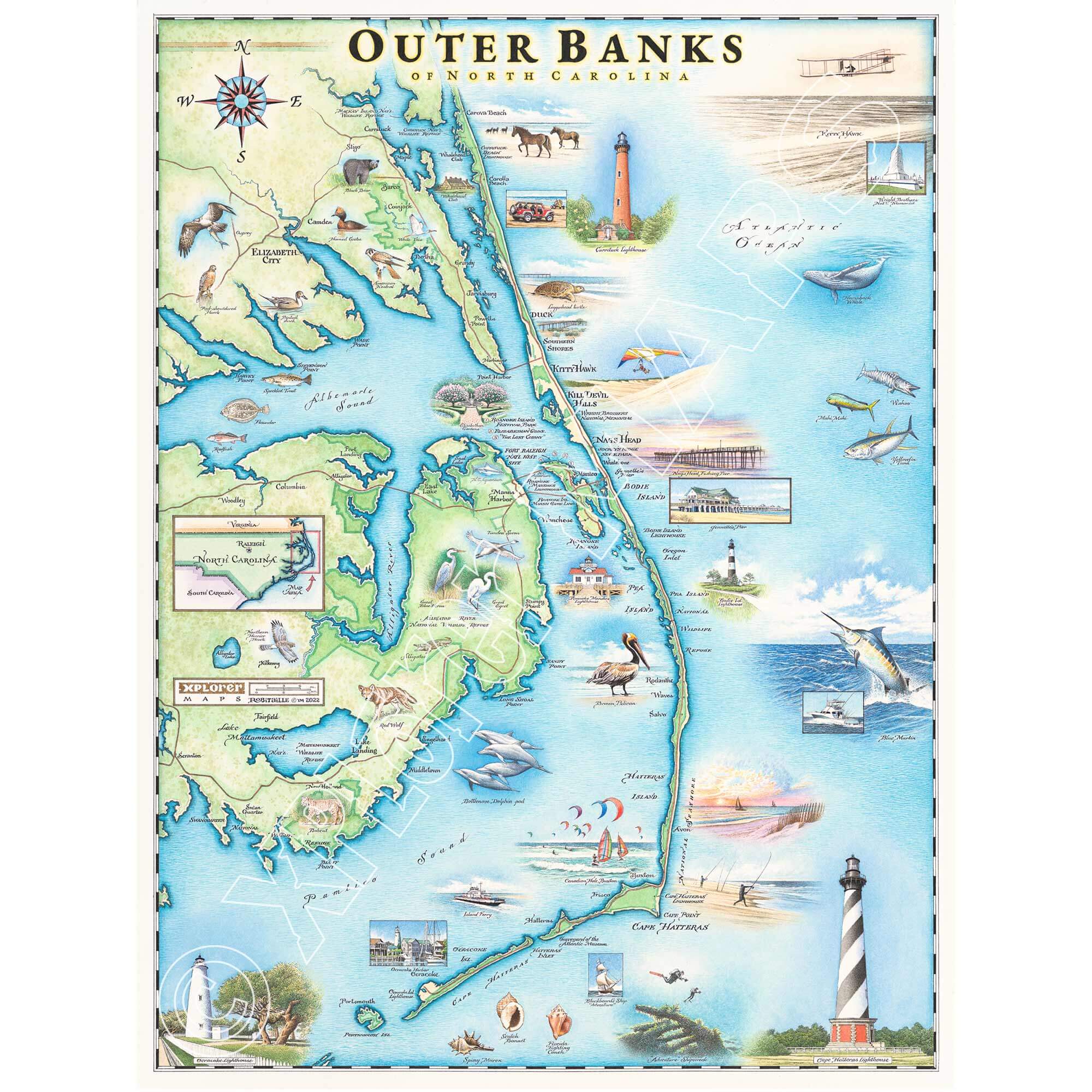
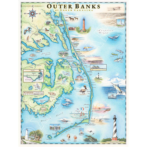
This 18” x 24” unframed lithographic art print features an original hand-illustrated map of North Carolina’s Outer Banks, created in pen and ink with watercolor by Xplorer Maps artist Chris Robitaille.
Stretching along the Atlantic coast, the barrier islands are known for windswept dunes, historic lighthouses, and maritime legend. The map highlights iconic landmarks including Cape Hatteras Lighthouse, the Wright Brothers National Memorial, and the chain of coastal villages that define the region’s character.
From wild beaches and shifting sands to tales of shipwrecks and early aviation, the composition captures both the natural beauty and layered history of the Outer Banks. Coastal wildlife, waterways, and ocean horizons are thoughtfully woven into the design, reflecting the spirit of this distinctive stretch of shoreline.
Blending cartographic precision with artistic storytelling, this piece serves as a meaningful tribute for beach lovers, sailors, history enthusiasts, and anyone drawn to the North Carolina coast.
As part of Xplorer Maps’ commitment to conservation, every purchase supports efforts that help protect the landscapes and communities represented in the artwork.
Dimensions: 18” × 24”
Orientation: Vertical
Print Type: Fine art lithograph
Artwork by: Chris Robitaille, Co-Founder of Xplorer Maps
Ships: Rolled in protective tube
Our on-line store is open 24/7 and we ship Monday through Friday, excluding some holidays. Orders received for products without shipping restrictions on its product page will ship the same business day when received before 12:00 p.m. PST. Orders in high demand will have an estimated production time listed on its product page and will ship according to the date listed.
The Xplorer Maps Warehouse Team strives to ship every order within 1 business day.
For custom orders (including framing), please allow 3-4 weeks for shipping.
Xplorer Maps ships all over the world, but prices and shipping times vary according to state, country, and the weight of items purchased. International recipients are solely responsible for any fees such as, but not limited to, VAT or import duties.
All prices will be charged according to your destination at check-out. This information is shown before your credit card is charged and you can click on the "calculate shipping charges" once an item has been placed in the cart to see the exact shipping based on your zip code.
We ship with UPS and USPS. Expedited shipping options are available at checkout.
Please be aware that despite our prompt shipping, factors beyond our control may occasionally lead to delays in the arrival of your order. For additional questions regarding shipping please email us at: store@xplorermaps.com