

Bundle & Save
Hand-Drawn Map Bundle - 4 for $100
$120.00


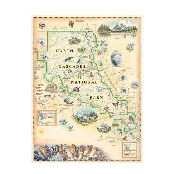
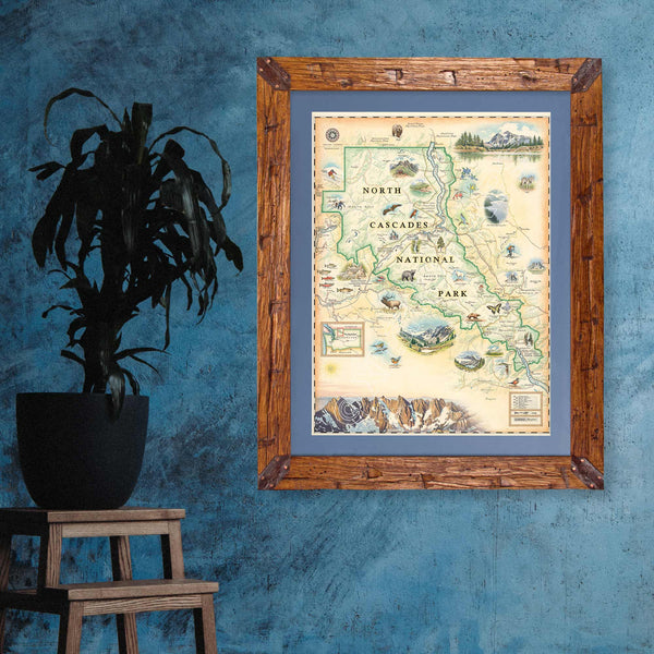
This 18” x 24” unframed lithographic art print features an original hand-illustrated map of North Cascades National Park, created in pen and ink with watercolor by Xplorer Maps artist Chris Robitaille.
Stretching along the U.S.–Canada border in northern Washington, North Cascades is one of the most rugged and glacier-rich landscapes in the lower 48. With more than 300 glaciers and sharply serrated peaks, the park is often called the “American Alps.”
The map captures dramatic summits such as Goode Mountain — the tallest peak in the park at 9,220 feet — and the iconic silhouette of Mount Shuksan. The landscape is divided into two primary sections: the North Unit, home to the remote Picket Range, and the South Unit, separated by the Skagit River corridor.
Recreation areas including Ross Lake and Lake Chelan National Recreation Areas are woven into the composition, alongside trail systems and access points that connect to the Pacific Crest Trail. Surrounding destinations such as Wenatchee National Forest and Mount Baker add geographic depth to the story of this alpine region.
Wildlife including mountain goats, grizzly bears, black bears, bald eagles, and salmon species reflect the park’s ecological richness, from alpine ridgelines to river valleys.
Blending cartographic precision with artistic storytelling, this piece captures the raw scale, glacial beauty, and remote wilderness that define North Cascades National Park.
Product Details
Dimensions: 18” × 24”
Orientation: Vertical
Print Type: Fine art lithograph
Artwork by: Chris Robitaille, Co-Founder of Xplorer Maps
Ships rolled in protective tube