


Double click image to zoom in


Click image to open expanded view
Bundle & Save
Hand-Drawn Map Bundle - 4 for $100
$120.00


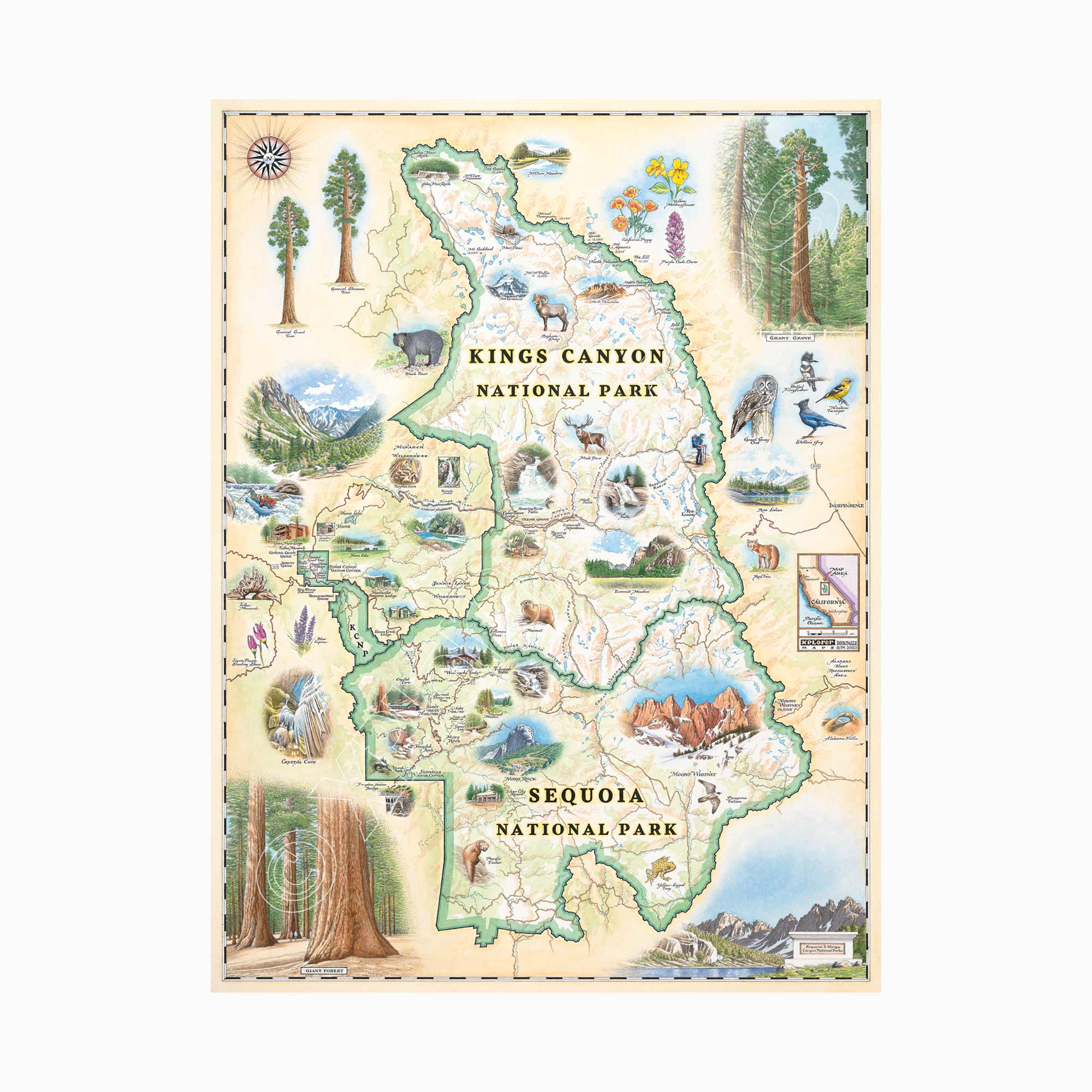
Bring the grandeur of California's Sierra Nevada into your home with this 18" × 24" hand-drawn lithographic map of Sequoia & Kings Canyon National Parks by Xplorer Maps. Created in pen and ink with watercolor by Xplorer Maps Co-Founder Chris Robitaille, this original illustration celebrates towering giant sequoias, Kings Canyon, Mount Whitney, alpine lakes, roaring waterfalls, granite peaks, caves, abundant wildlife, and the unforgettable landscapes that make these neighboring parks world-renowned.
Every detail reflects the beauty and adventure found among some of the largest trees and highest mountains in the United States. Whether displayed in a home, cabin, office, or mountain retreat, this fine art print is both a conversation piece and a lasting keepsake.
Our on-line store is open 24/7 and we ship Monday through Friday, excluding some holidays. Orders received for products without shipping restrictions on its product page will ship the same business day when received before 12:00 p.m. PST. Orders in high demand will have an estimated production time listed on its product page and will ship according to the date listed.
The Xplorer Maps Warehouse Team strives to ship every order within 1 business day.
For custom orders (including framing), please allow 3-4 weeks for shipping.
Xplorer Maps ships all over the world, but prices and shipping times vary according to state, country, and the weight of items purchased. International recipients are solely responsible for any fees such as, but not limited to, VAT or import duties.
All prices will be charged according to your destination at check-out. This information is shown before your credit card is charged and you can click on the "calculate shipping charges" once an item has been placed in the cart to see the exact shipping based on your zip code.
We ship with UPS and USPS. Expedited shipping options are available at checkout.
Please be aware that despite our prompt shipping, factors beyond our control may occasionally lead to delays in the arrival of your order. For additional questions regarding shipping please email us at: store@xplorermaps.com