


Double click image to zoom in


Click image to open expanded view

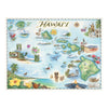
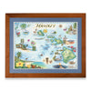
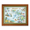
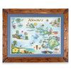
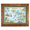
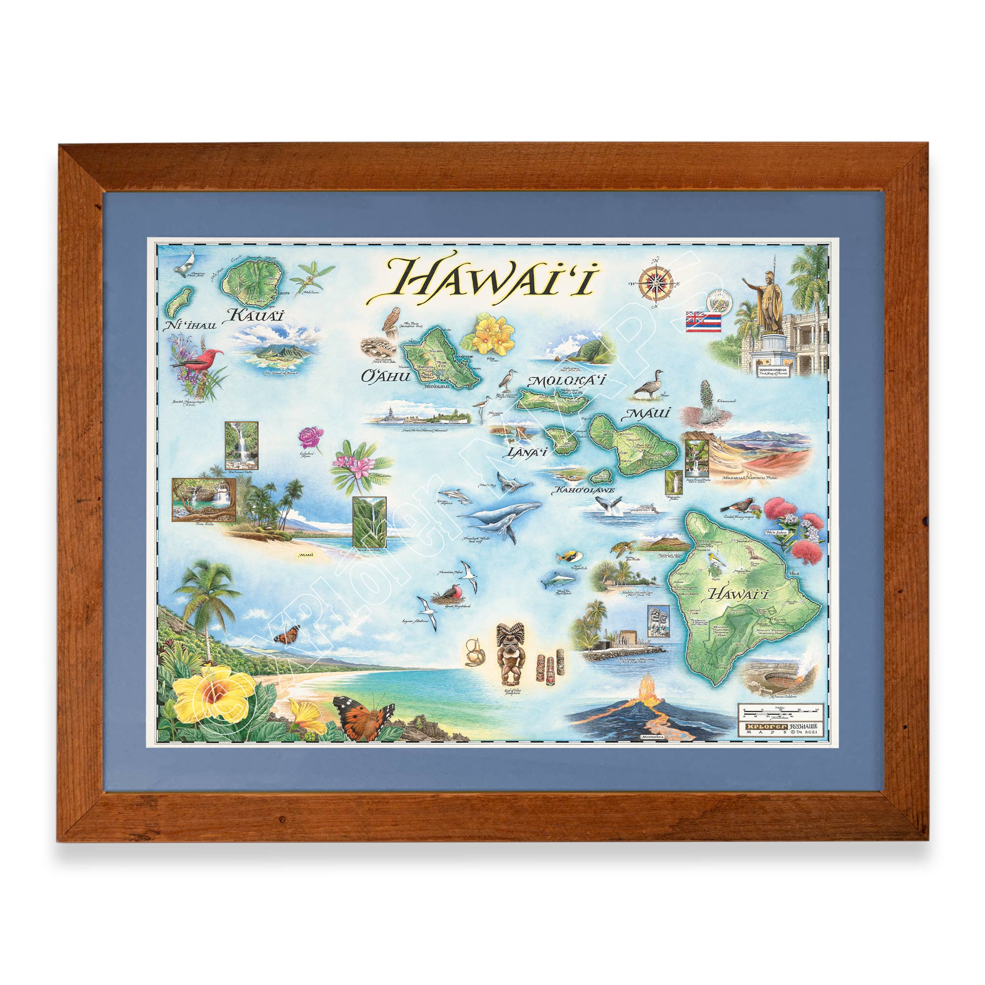
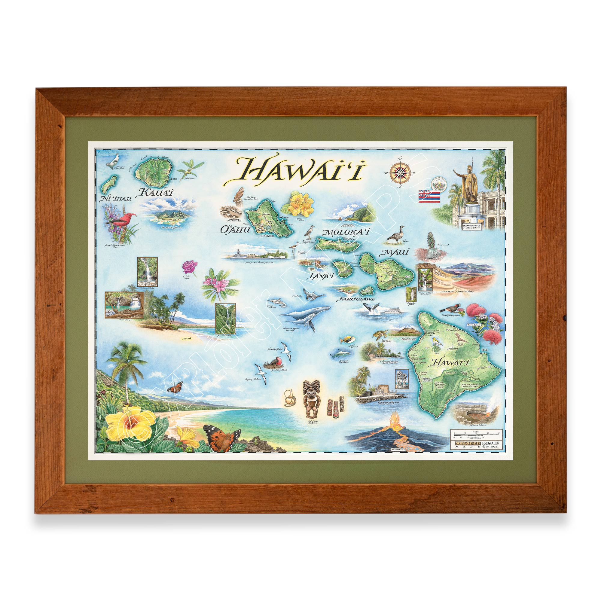
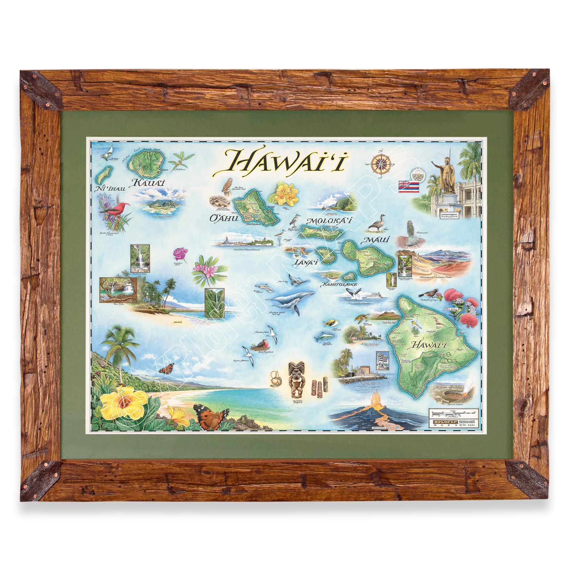
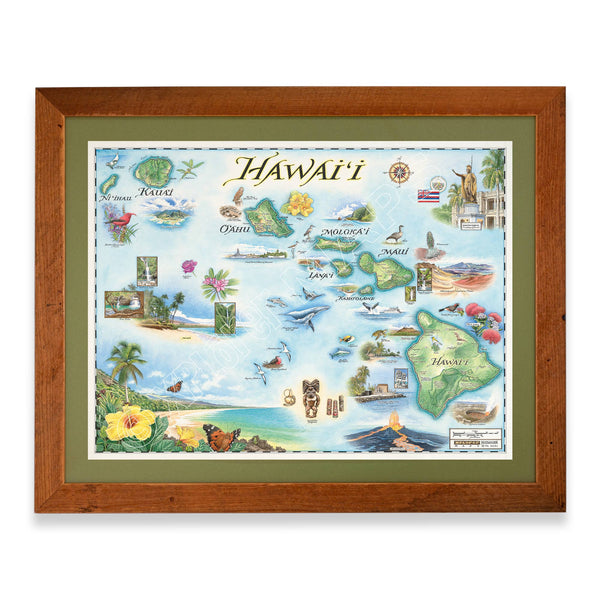
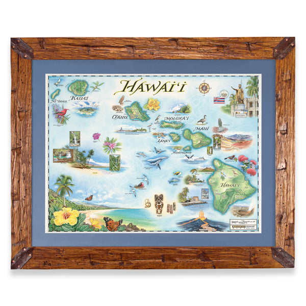
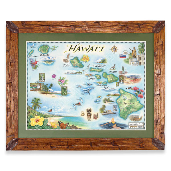
Original hand-drawn pen and ink/watercolor story map of one of the most unique, and youngest states of the United States of America, Hawaii, also known as the Aloha State and Paradise of the Pacific. This map celebrates the vibrant, tropical paradise located about 2,400 miles west of the continental U.S. in the Pacific Ocean. The eight-island chain featuring the islands: Hawaii, Maui, Kaho’olawe, Lana’i, Moloka’i, O’ahu, Kaua’i, and Ni’ihau, is the result of a tectonic plate that has passed over a volcanic hot spot creating a chain of islands that range in age with the oldest in the northwest.
Being physically separate and distant from the contiguous United States, Hawaii has a tropical climate that creates ecosystems perfect for a variety of plants and animals to thrive. The rainforests, beaches, and reefs are home to: green sea turtles, black tip reef sharks, reef triggerfish, humpback whales, manta rays, spinner dolphins, Hawaiian monk seals, Scarlet Honeycreepers, Lokelani Roses, and Yellow Ilmas.
This map highlights features that make each island unique as well as attract millions of adventurers and tourists to complete at least one bucket list trip of their life. The big island, Hawai’i home to the first king of Hawai’i, King Kamehameha, features: Pu’uhonua O Honaunau National Historical Park (Hawai’i), Kaloko-Honokohau National Historical Park (Hawai’i), Pu'ukohola Heiau National Historic Site. Maui, to the north showcases: Haleakala National Park (an unparalleled park in its beauty with brilliant rock colors formed from volcanic activity), Seven Sacred Pools, Waimoku Falls, Waikamoi Falls, Twin Falls, and Honokohau Falls. The island of Kaho’olawe includes Pu’u Moaulanui. West of Maui, Lana’i has the mountain Lana’ihale. The next island to the north Moloka’i boasts the stunning Kalaupapa National Historical Park. O’ahu, home to the capital of Hawaii, Honolulu, also features the Honouliuli National Historical Site, as well as the historic Pearl Harbor National Memorial. Farthest north, the islands of Ni’ihau and Kaua’i (the garden island) include the unparalleled Na Pali coast as well as extraordinary plants and wildlife.
The lithograph print by Chris Robitaille of Xplorer Maps is 24” tall by 18” wide.
Are you looking for a custom matted and framed piece? Pick from Montana hand-scraped pine or reclaimed Flathead Lake larch. In addition, you can choose between green or blue mats.
* The framed map is for retail purchase only. Xplorer Maps does not offer wholesale pricing on framed maps.
Montana's Flathead Lake larch Frame - 10%of the larch logs originally intended as railroad ties for the Great Northern Railroad sunk to the bottom of Flathead Lake, MT. These over 100-year-old logs have been dive-located, dredged, dried, cured, planed, scraped, sawn, sanded, and shaped into reclaimed heritage wood frames exclusively for Xplorer Maps.
Hand-Scraped Montana Pine - Montana forest-harvested pine frame. For that rustic look, each frame is hand-scraped.
All frames are equipped with conservation clear glass, which is guaranteed to block 99% of ultraviolet rays. Upgrade to Museum glass, which ensures 99% UV protection but also provides ZERO GLARE - this is the quality glass you would find in gallery settings.
Our on-line store is open 24/7 and we ship Monday through Friday, excluding some holidays. Orders received for products without shipping restrictions on its product page will ship the same business day when received before 12:00 p.m. PST. Orders in high demand will have an estimated production time listed on its product page and will ship according to the date listed.
The Xplorer Maps Warehouse Team strives to ship every order within 1 business day.
For custom orders (including framing), please allow 3-4 weeks for shipping.
Xplorer Maps ships all over the world, but prices and shipping times vary according to state, country, and the weight of items purchased. International recipients are solely responsible for any fees such as, but not limited to, VAT or import duties.
All prices will be charged according to your destination at check-out. This information is shown before your credit card is charged and you can click on the "calculate shipping charges" once an item has been placed in the cart to see the exact shipping based on your zip code.
We ship with UPS and USPS. Expedited shipping options are available at checkout.
Please be aware that despite our prompt shipping, factors beyond our control may occasionally lead to delays in the arrival of your order. For additional questions regarding shipping please email us at: warehouse@xplorermaps.com
Email: Info@xplorermaps.com
Brick-and-Mortar Address: 1245 S 3rd ST W; Missoula, MT 59801
Phone: 406-546-4972
Warehouse Address: 500 S Inez ST; Missoula MT 59801
© 2024, Xplorer Maps


