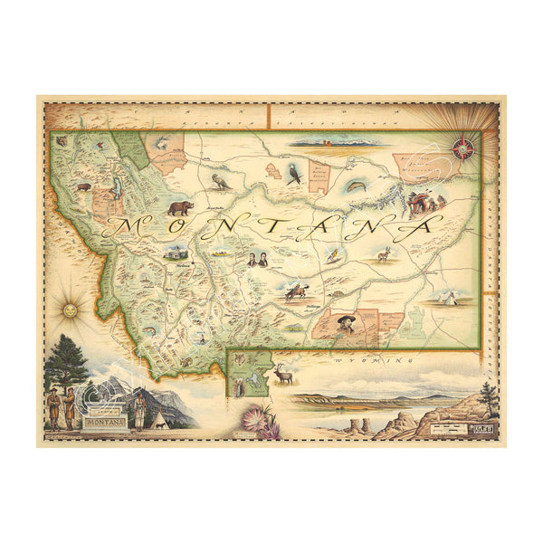
This Lithographic Map Art Print features a hand-illustrated map of Montana. Original hand-drawn pen and ink/watercolor artwork by Chris Robitaille of Xplorer Maps. The map is featuring Sacajawea, Lewis & Clark, Yellowstone, Glacier National Park, Flathead Lake, Missoula, Bozeman, Helena, and Whitefish. The Big Sky State Map is 24" wide by 18" tall.
4
Montana State Hand-Drawn Map
Price
$29.99$675
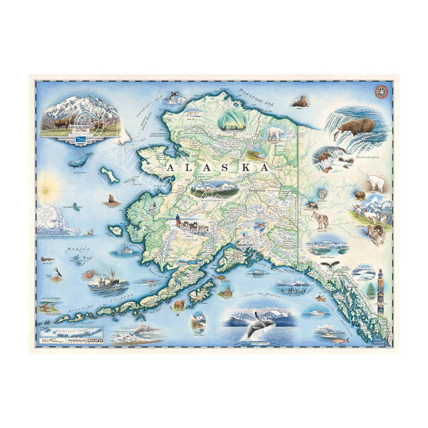
Alaska State hand-drawn map in earth tone colors of blues and greens. The Map features Anchorage, Juneau, Fair Banks, Denali National Park, Iditarod Trail Sled Dog Race, bears, elk, moose, whales, a mountain goat & a sheep.  24x18
4
Alaska State Hand-Drawn Map
Price
$29.99$675
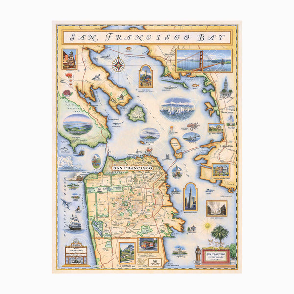
San Francisco Bay hand-drawn map in earth tones of beige, green, and blue earth tones. The map features illustrations of places such as Candlestick Park, Fisherman's Wharf, Transamerica Pyramid, and Alcatraz Island. Flora and fauna include octopus, crab, palm trees, and a dahlia. Measures 18x24."
San Francisco Bay Hand-Drawn Map
Price
$29.99$675
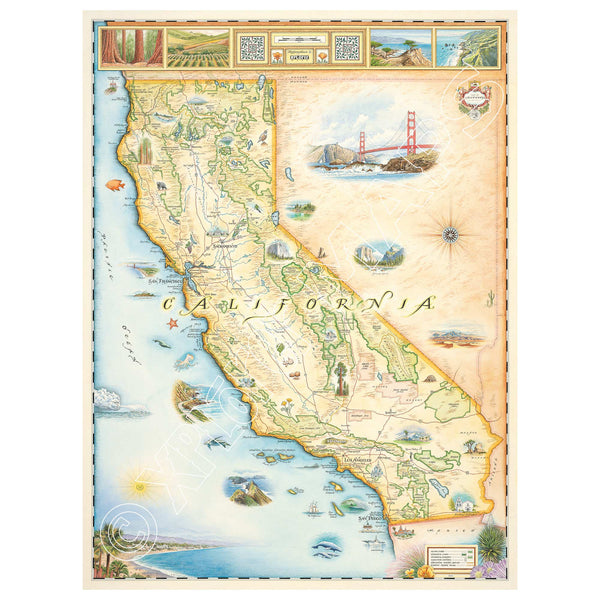
This is an 18x24 hand-drawn map of California and Boston, Massachusetts, and features earth tones of beige, blue, and green. It highlights major cities like Sacramento, San Francisco, Los Angeles, San Diego, and Hollywood. The map also includes illustrations of various aquatic life, such as whales, sea turtles, and different fish species. Additionally, it features popular national parks and attractions like Yosemite, Sequoia, Disneyland, Redwood Forest, Golden Gate Bridge, and Death Valley.
3
California State Hand-Drawn Map
Price
$29.99$675
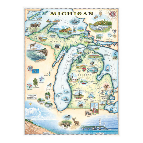
Michigan State Hand-Drawn Map in earth tones. Featuring the Great Lakes, Detroit, Ann Arbor, Grand Rapids, and Lansing in earth tones colors. The Print also features Nature, animals, ducks, deer, fish, moose lighthouses, wolverines, and the Mackinac Bridge. Measures 18x24."
Michigan State Hand-Drawn Map
Price
$29.99$675
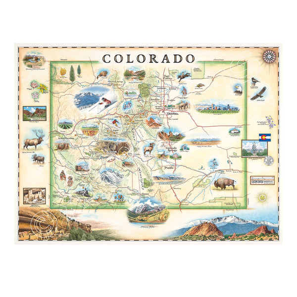
This is a hand-drawn map of Colorado in earthy beige and green tones. It showcases various cities including Denver, Fort Collins, Colorado Springs, Aspen, and Durango. It also features local flora and fauna, such as moose, Rocky Mountain elk, turtles, eagles, and Bighorn Sheep, as well as the indigenous Navajo and Hopi peoples. The map highlights popular activities like hiking, biking, rafting, and skiing. Measuring 24x18
4
Colorado State Hand-Drawn Map
Price
$29.99$675
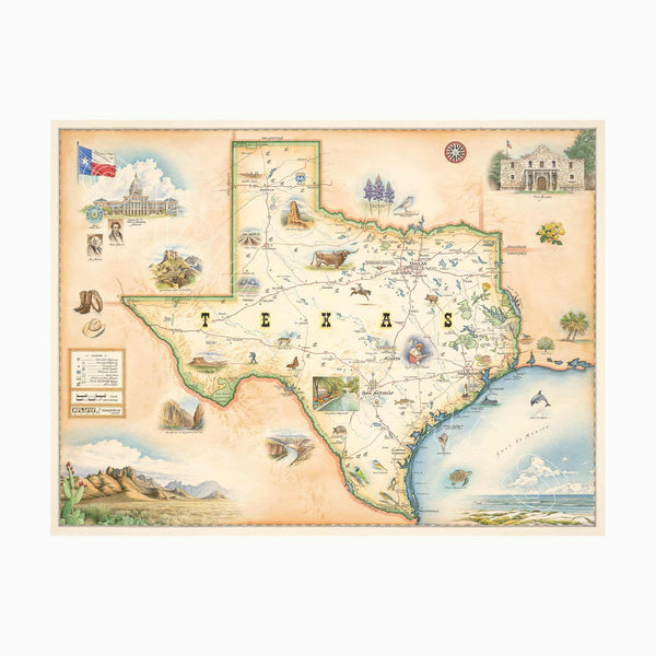
Texas state hand-drawn map in earth tones brown and beige. The map features illustrations of places such as the Alamo, San Antonio Riverwalk, and Guadalupe National Park. Flora and fauna include venus flytrap, longhorns, Monarch butterfly, and armadillo. Measures 24x18."
1
Texas State Hand-Drawn Map
Price
$29.99$675
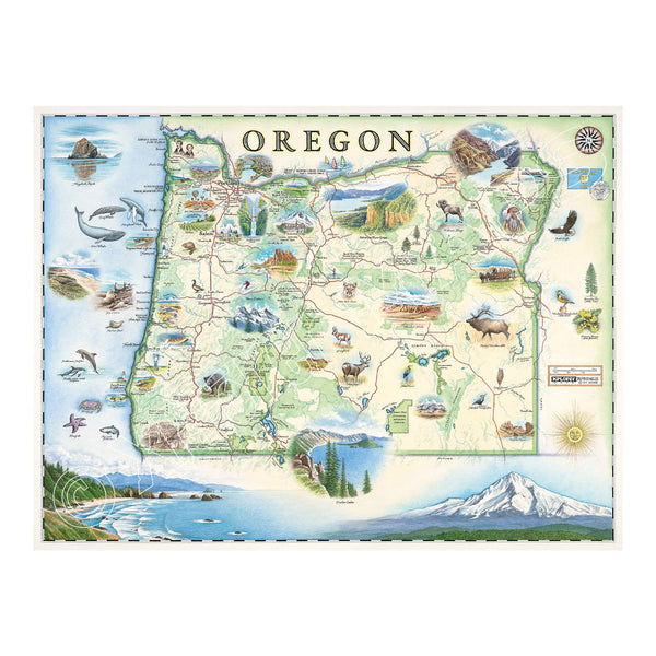
Oregon state hand-drawn map in earth tones green and blue. The map features illustrations such as Hells Canyon Snake River, the Columbia River Gorge, Multnomah Falls, and Crater lake. Flora and fauna include blue whale, big horn sheep, Dungeness crab, Oregon grape, and Douglas Fir. Measures 24x18."
3
Oregon State Hand-Drawn Map
Price
$29.99$675
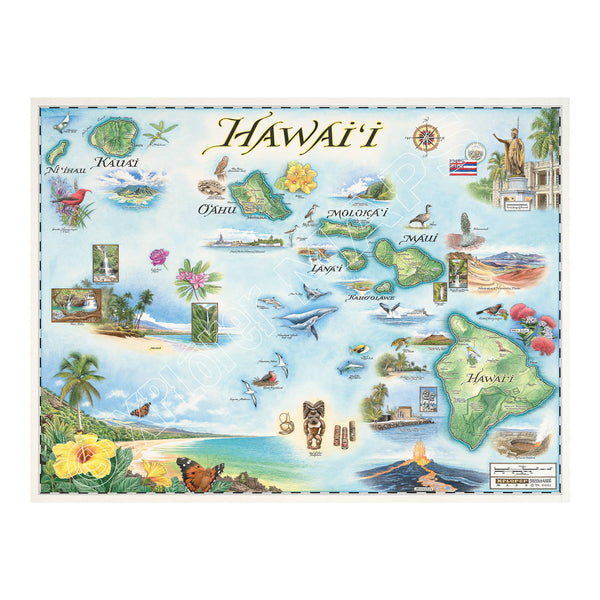
Hawaii state hand-drawn map in earth tones blue and green. The map features the islands of Hawaii, Maui, Kaho'olawe, Lanai, Molokai, Oahu, Kauai, and Ni'ihau. Flora and fauna of islands include, the Scarlet Honeycreeper, Lokelani Rose, and green sea turtles. Other illustrations include statue of King Kamehameha, Pearl Harbor National Memorial, and Mauna Loa erupting. Measures 24x18."
Hawai'i State Hand-Drawn Map
Price
$29.99$675