Original Hand-Drawn Story Maps

Our Hand-Drawn Story Maps look great anywhere! All Xplorer Maps lithographic prints are produced on heavy-duty, 80 lb. cover stock using soy-based inks and 50% post-consumer materials. This ensures high-quality, eco-friendly prints that capture the detailed artistry of our maps while supporting sustainability.

  • High-Quality Lithographic Prints: Produced on heavy-duty, 80 lb. cover stock.
  • Eco-Friendly Materials: Uses soy-based inks and 50% post-consumer materials.
  • Sustainable Production: Supports environmental sustainability with eco-conscious materials.

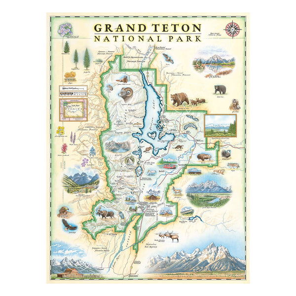
Grand Teton National Park hand-drawn map in earth tone colors of beige and blue. The map includes flora and fauna of the area, such as grizzly bear, moose, coyote, lupine, and longleaf phlox. Illustrations of places include snake river overlook, jenny lake, and Colter Bay village. Measures 18x24."
2
Grand Teton National Park Hand-Drawn Map
Price
$29.99$675
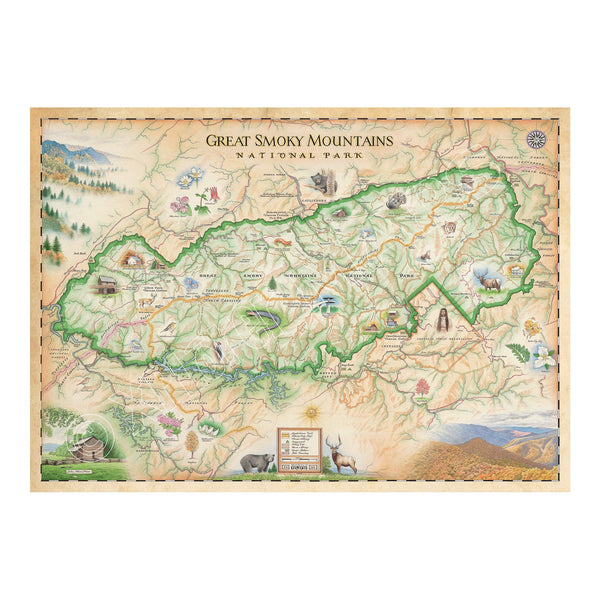
Great Smoky Mountains National Park hand-drawn map in earth tones colors beige and green. The map depicts the entire National Park on the border of North Carolina and Tennessee. It features illustrations of salamander, woodpecker, Clingman's Dome, Sugarland's Visitor Center, Oconoluftee Visitor Center. Measures 24x18."
3
Great Smoky Mountains National Park Hand-Drawn Map
Price
$29.99$675
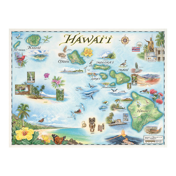
Hawaii state hand-drawn map in earth tones blue and green. The map features the islands of Hawaii, Maui, Kaho'olawe, Lanai, Molokai, Oahu, Kauai, and Ni'ihau. Flora and fauna of islands include, the Scarlet Honeycreeper, Lokelani Rose, and green sea turtles. Other illustrations include statue of King Kamehameha, Pearl Harbor National Memorial, and Mauna Loa erupting. Measures 24x18."
Hawai'i State Hand-Drawn Map
Price
$29.99$675
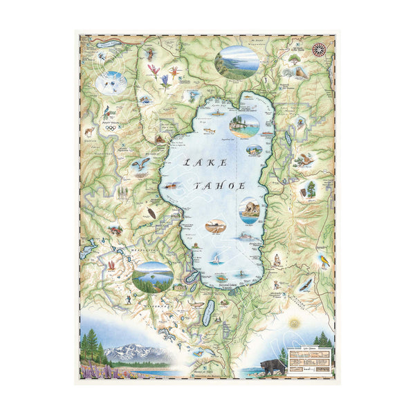
Lake Tahoe Hand-drawn map in colors green and blue. Bordering Nevada, this destination map features the land's topography along with the area's flora and fauna, such as Emerald Bay, Cove Rock, Thunderbird Lodge, and Cal Neva Lodge & Resort.
1
Lake Tahoe Hand-Drawn Map
Price
$29.99$675
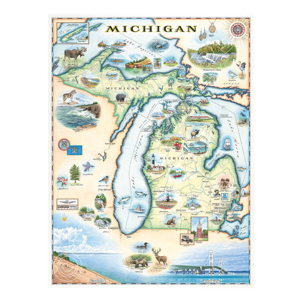
Michigan State Hand-Drawn Map in earth tones. Featuring the Great Lakes, Detroit, Ann Arbor, Grand Rapids, and Lansing in earth tones colors. The Print also features Nature, animals, ducks, deer, fish, moose lighthouses, wolverines, and the Mackinac Bridge. Measures 18x24."
Michigan State Hand-Drawn Map
Price
$29.99$675
Hand-drawn map of Missoula in vibrant greens and blues, featuring iconic landmarks like the M Mountain, University of Montana, Carousel, KettleHouse Amphitheater, Missoula Marathon, Griz Football, along with abundant wildlife and river activities.
Missoula Hand-Drawn Map
Price
$50$995
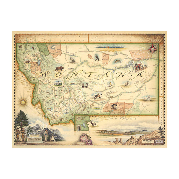
This Lithographic Map Art Print features a hand-illustrated map of Montana. Original hand-drawn pen and ink/watercolor artwork by Chris Robitaille of Xplorer Maps. The map is featuring Sacajawea, Lewis & Clark, Yellowstone, Glacier National Park, Flathead Lake, Missoula, Bozeman, Helena, and Whitefish. The Big Sky State Map is 24" wide by 18" tall.
4
Montana State Hand-Drawn Map
Price
$29.99$675
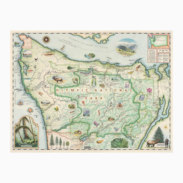
Olympic National Park hand-drawn map in earth tones green & beige. The map features illustrations of the park such as Enchanted Valley Chalet, Sol Duc Hot Springs Resort, Hurricane Ridge Visitor Center, and Kalaloch Lodge. Flora and fauna include sea otter, Roosevelt elk, Chinook salmon, skunk cabbage, and Flett's Violet. Measures 24x18."
5
Olympic National Park Hand-Drawn Map
Price
$29.99$675
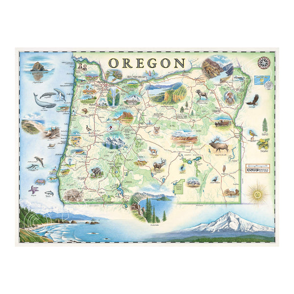
Oregon state hand-drawn map in earth tones green and blue. The map features illustrations such as Hells Canyon Snake River, the Columbia River Gorge, Multnomah Falls, and Crater lake. Flora and fauna include blue whale, big horn sheep, Dungeness crab, Oregon grape, and Douglas Fir. Measures 24x18."
3
Oregon State Hand-Drawn Map
Price
$29.99$675