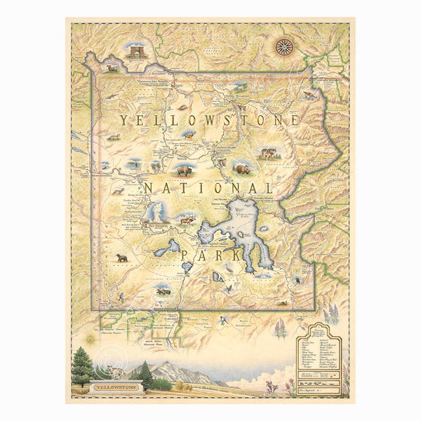
Yellowstone National Park Hand-Drawn Map
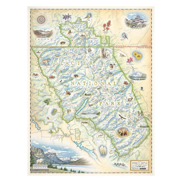
Glacier National Park Hand-Drawn Map
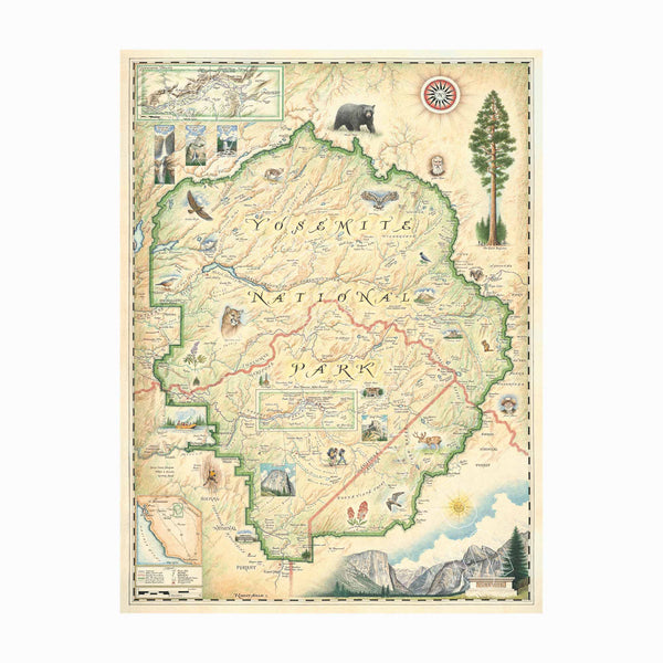
Yosemite National Park Hand-Drawn Map
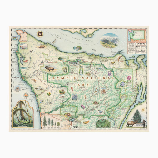
Olympic National Park Hand-Drawn Map
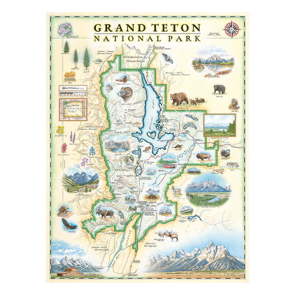
Grand Teton National Park Hand-Drawn Map
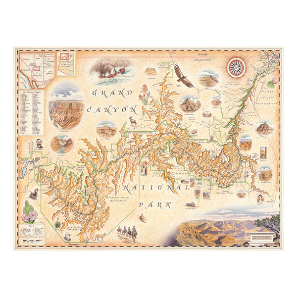
Grand Canyon National Park Hand-Drawn Map
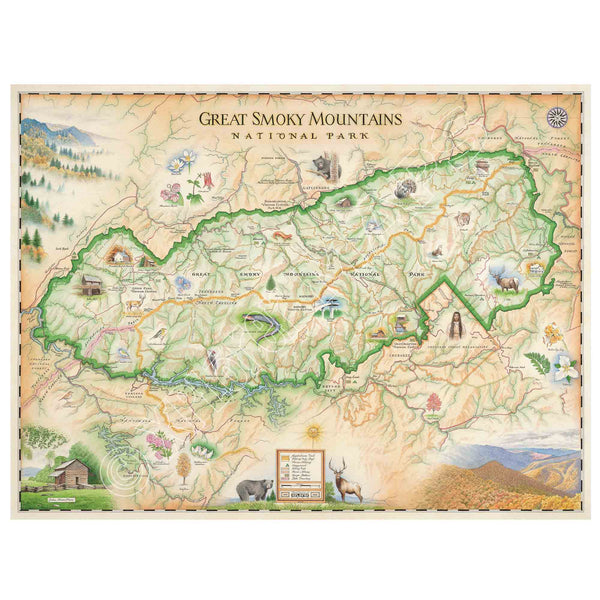
Great Smoky Mountains National Park Hand-Drawn Map
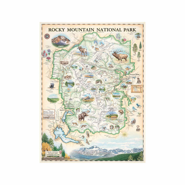
Rocky Mountain National Park Hand-Drawn Map
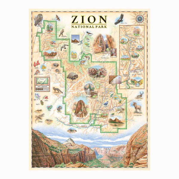
Zion National Park Hand-Drawn Map
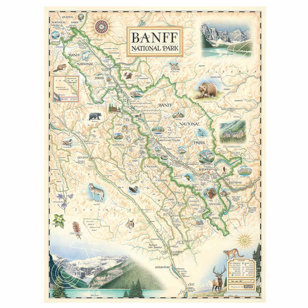
Banff National Park Hand-Drawn Map
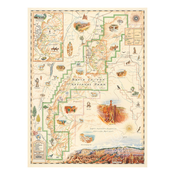
Bryce Canyon National Park Hand-Drawn Map
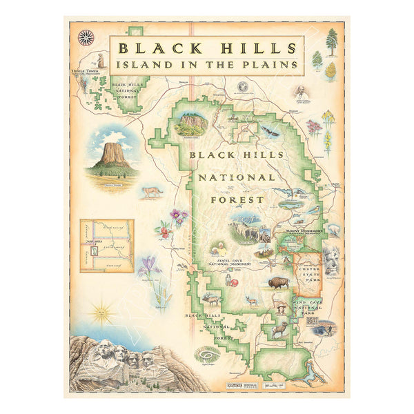
Black Hills National Forest Hand-Drawn Map